 2
2A pair of poster-size lunar maps, produced by the U.S. Geological Survey, let you roam around the Moon's surface and explore the lunar landscape.
The editors of Sky & Telescope have a close, decades-long friendship with the talented planetary scientists and cartographers at the U.S. Geological Survey's Astrogeology Science Center in Flagstaff, Arizona. Over the years the "Flag" team has been instrumental in preparing the base maps used for our planetary globes, and the Gazetteer of Planetary Nomenclature it maintains for the International Astronomical Union is the unrivaled, go-to source for information about named solar-system features.
This relationship recently paid yet another dividend when USGS staff scientist Trent Hare alerted me to a pair of lunar maps that he and other researchers had created from NASA's Lunar Reconnaissance Orbiter data amassed from 2009 to 2013. Made available to Sky & Telescope by special arrangement, these large wall maps measure a generous 46 by 41 inches and reveal Earth's nearest neighbor with the kind of close-up detail that you'd see through a telescope. They come folded in a convenient storage sleeve.
Trent Hare & Others / USGS
Trent Hare & Others / USGS
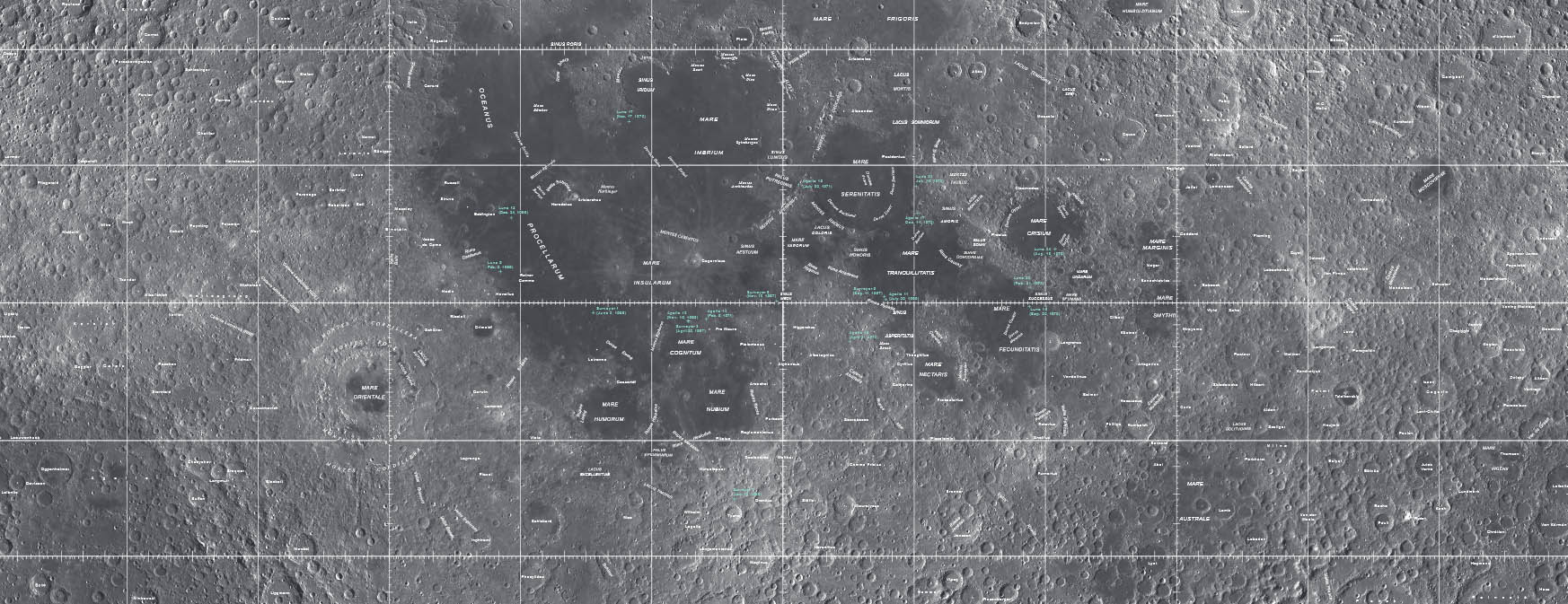
Portions of both maps are shown above. The top one is a mosaic of images from LRO's wide-angle camera, and it shows the Moon as it appears to the eye — with sharply defined craters and subtle light-and-dark shadings across the vast lunar plains. Several hundred features are named.
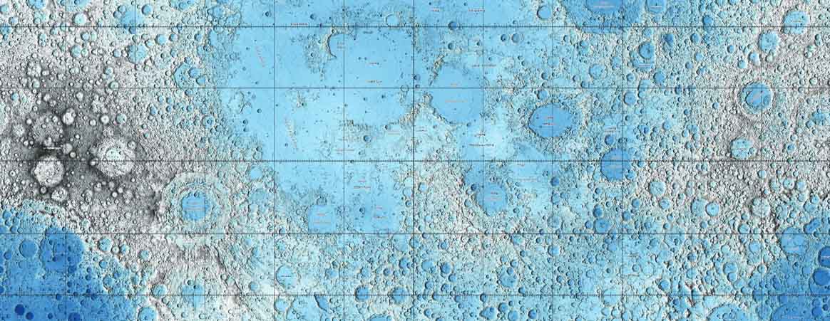
The second map, derived from 6½ billion individual measurements from the spacecraft's Lunar Orbiter Laser Altimeter, reveals the highs and lows of lunar topography using a color-coded altitude scale. The range of lunar altitudes spans nearly 12½ miles (20 km) — a very slightly greater range of elevations than on Earth, as it turns out.
Both maps use a Mercator projection to portray latitudes between 57° north and 57° south, and a polar stereographic projection for each polar region (latitudes from 55° to 90°).
Trent Hare & Others / USGS
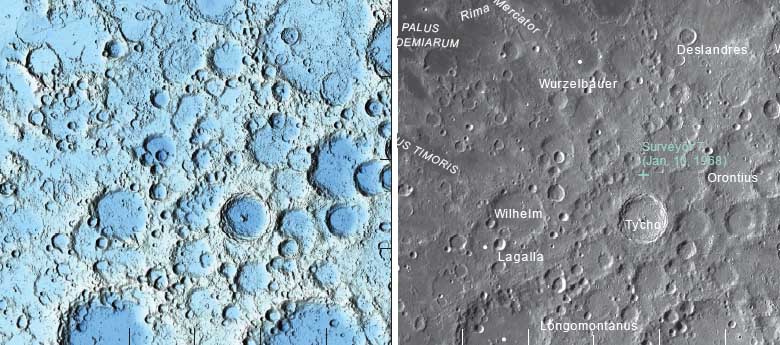
I've used these maps pf the Moon to imagine myself roaming around the landscape or perhaps swooping low over its features. For example, you might think that Tycho, the iconic 85-km-wide crater whose bright rays are splashed all across the southern highlands, would be a real standout in the topographic map. But no! Take a look at right. Unless you already knew that Tycho has a prominent central peak, you'd be hard pressed to pick it out in the topographic portrayal.
Among my other favorite lunar locales are the north and south polar regions. The Sun never shines in some of the craters there, a coincidental consequence of the slight (5.1°) tilt of the Moon's orbit with respect to the ecliptic plane — and the oppositely directed 6.7° tilt of its spin axis with respect to its orbit. Some of those craters never see temps above 40 Kelvin (–390°F) and have water ice in them!
I'm sure I'll find more lunar oddities to share with you — or get these maps for yourself and do your own exploring.
Sky & Telescope's growing assortment of planetary maps and globes will appeal to anyone interested in our solar system.

Comments
GH Martin
September 25, 2015 at 9:43 pm
How about making these maps available online in 20+ Meg files?
You must be logged in to post a comment.
Fred Shuman
September 28, 2015 at 11:38 am
Glad to see there's an overlap - 2º worth - in latitude, between the cylindrcal and polar segments of the maps.
Be nice if there were some overlap in longitude, say 5º?, between the east and west edges of the cylindrcal maps.
Such overlaps help prevent lots of edge features from getting "chopped up."
You must be logged in to post a comment.
You must be logged in to post a comment.